
First Draft
As I recall, image maps are pretty easy. Mind you, the last time I made one was about 20 years ago so I had to look up the tags. The hard part will be finding the best place to host it - and this blog might not work for that - and, even more difficult: preparing the content!
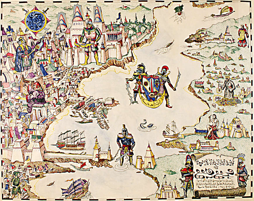
So here is my first draft of where the "hot spots" will be located. Note that they are all numbered "1". That is because I have yet to order them in any way. My thinking is that the actual "#1" will be the plaque, lower right. I already posted the translation. Then the numbering would follow on from the features it describes. And then perhaps use the traveler's description in the blue solo book and identify those spots.
My tentative plan is that the header image would be the image map - assuming I use the correct widget - and that the hot spots would link to individual blog posts. My thinking with keeping the hot spot size relatively small is that I might be able to cram them in as we identify the buildings shown in the city. Note that I say "We" - I'm probably going to need assistance identifying features and coming up with content. :-)
I have explored Béy Sü before, and my previous blog entries about the city can be found HERE.
No comments:
Post a Comment